
At GIS Planning, we are always working to improve our software applications - and we get our best ideas from our clients. Our customers told us they wanted to display their full inventory of sites and buildings on ZoomProspector, their GIS data mapping tool, in ways that would be immediately obvious and meaningful to their website visitors.
Our design and development team rose to the challenge with enthusiasm - we've always prided ourselves in combining our GIS and economic development expertise with great user experiences. After some experimentation, we found the optimal solution. The resulting update to the industry's leading online data tool for corporate site selection isn't just one change but rather a combination of additions that simultaneously makes our map now more intelligent and more user-friendly.
1) Smart Bubbles
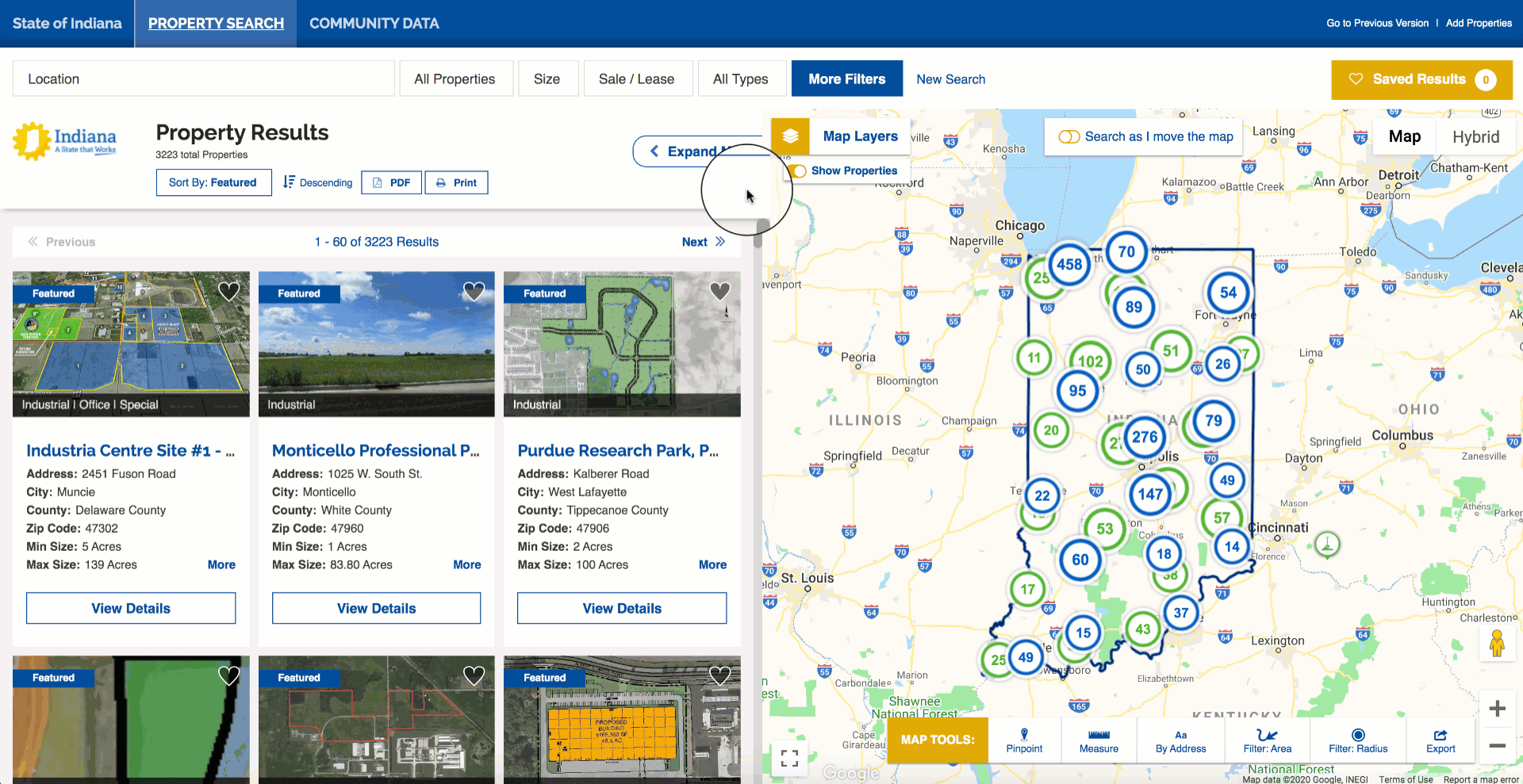
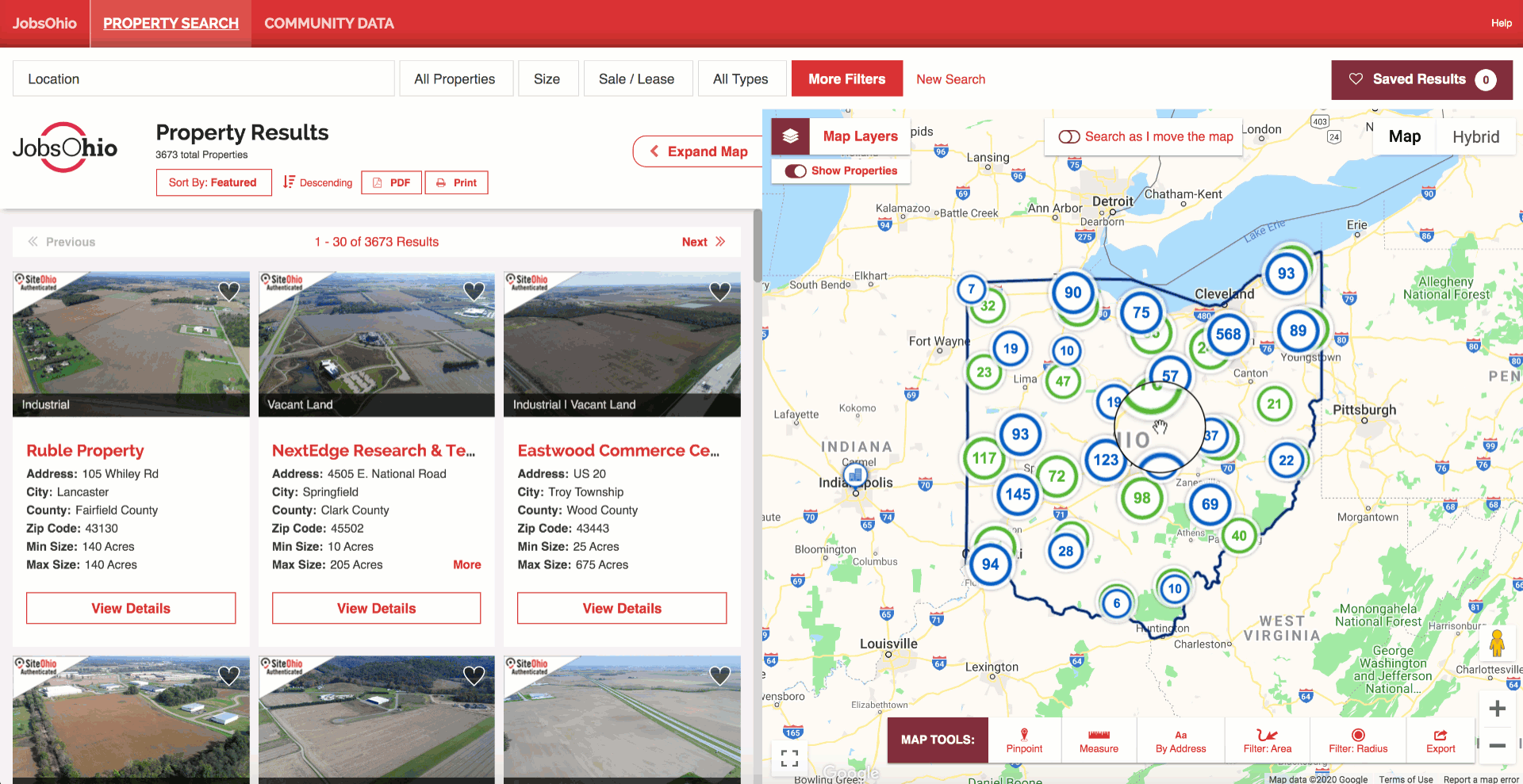
One of the challenges in the design of web maps is marker overload. That’s when you have a bunch of points in a small area and they start to overlap, thereby losing their ability to tell a clear story.
Displaying fewer markers on the map would be the first response to the problem - but we were asked to do the opposite: show more, without losing data. That led to the development of our GIS Planning Smart Bubbles.
This is how it works: The GIS Planning algorithm looks for map markers that are near each other within a certain radius and then represents all those separate dots as a new cluster, indicated by the blue or green bubble (for sites and building, respectively). We then added a number inside the bubble to represent all the nearby points. The icons are smart because as you click on them, the results refresh on the fly. This dramatically improves the user experience a lot better.
The number on a smart bubble indicates how many properties it contains. Notice that as you click into any of the cluster, the number on the bubble decreases, and you begin to see the individual properties on the map.

The GIS Planning begins by recognizing a property type from the dataset. It then searches for all points within a certain radius around that point to form a new Smart Bubble. The algorithm then chooses a new point that isn’t part of a cluster, and repeats the process until we have located all the properties visible on the map.

Sites and Buildings get their own Smart Bubbles
With the launch of our new redesign in 2019, GIS Planning's ZoomProspector has offered the ability to search for buildings and sites separately or together. Of course, we didn’t want to sacrifice that functionality.
By adding a bit more coding to the recipe, our excellent engineers made it possible to continue representing sites and buildings as distinct property types for searches. Blue smart bubbles represent buildings and green ones indicate sites. This smart technology allows website users to distinguish between property types at a glance.
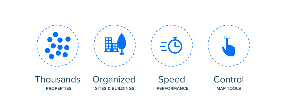
Our clients told us what they needed and we took up the challenge. With the new GIS Planning Smart Bubbles, thousands of properties of any property type can be displayed in meaningful ways on the map, enhancing speed, performance and functionality.
2) Redo Search in Map
We wanted to give users a better experience when searching for properties on the map. If Smart Bubbles provide an intelligent way to display a bunch of points without impacting speed and organization, Redo Search in Map gives the users the ability to zoom in or out to any section of the map and generate results just for that specific area.
This is definitely an improvement in our search functionality. Not only you can use the location filter to enter a specific community name, but now you can browse the map to find the target area in which you are most interested - this could be around a train track, a freeway or even an isolated area.
Map view and List view
Our split view, between map and list view side by side is one of our customers' favorite features. We were careful to maintain its integrity with all these new additions. That’s why, the user will see that properties not only automatically update on the map when clicking on a Smart Bubble or Redo the Search in Map, but they will also appreciate that the list will automatically refresh to provide the same content as you see on the map. That's true dynamic searching.
3) More control: Search as I move the map
We went one step further to give users even more control. If you would like to see properties updating live as you interact with the map, you can do so by activating the “Search as I move the map” functionality. By default, it will be turned off to enhance the experience of the Smart Bubbles and Redo Search in Map tools. However, at any time users can turn it on with just one click and see the properties update on the fly as they navigate through the client’s boundary geography.
4) Hide the properties, please
Our clients choose GIS Planning's corporate site selection data tools for their unmatched capacity for data analysis and data visualizations and mapping. They know their website visitors appreciate the level of value-added interactivity for research. So we wrapped up all these product updates with functionality that empowers the user to click on and off the new Smart Bubbles and property points on the map.
One single click clears the map of any property information being displayed, allowing for analysis with Map Layers and Thematic Heat Maps without any markers that might slow down the process of analysis. We're giving the user the power to decide whether to view the map alone for data analysis or to display it with the properties.