

As I look forward to next week's EDCO Time for TransformatiON conference in Toronto, followed in April by the EDA Xperience in Kananaskis, Alberta and then BCEDA's BC Economic Summit in Penticton, I've been thinking back on the more than ten years we've been offering GIS Planning's suite of top-ranked online GIS data tools across Canada. Perhaps it's celebrating our company's milestone 25th year in business that has me in a reflective mood or the excitement of meeting up again with friends, clients and colleagues at these wonderful annual events.
While both of those things are true, they are also mixed with my pride as a Canadian in seeing these tools working hard to drive investment, create jobs and support businesses in provides across the country. It feels good to be part of the solutions that make a difference. You can see some of our client sites at the links below:
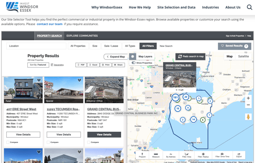
- Invest WindsorEssex
- Burlington Economic Development (ON)
- Locate Ottawa
- Edmonton Global
- City of Swift Current (SK)
- City of Mount Pearl (NL)
It has also occurred to me that it would be useful to summarize the many reasons why GIS Planning Canada remains the fastest-growing and most innovative online GIS software solution provider for economic development and corporate site selection across the country.
- We understand there is a "u" in "labour" and "colour", the correct spelling of "centre," when to order a double double, the appeal of the CFL, and that distance is calculated in kilometres
- GIS Planning is legally incorporated in Canada and one of our team members (me!) lives in Montréal
- GIS Planning has worked with clients in seven different provinces. More than 67% of North Americans live in territory serviced by our data solutions.
- Our data comes from a variety of sources, including Ontario's Environics Analytics (benchmarked against Statistics Canada) and Lightcast (formerly known as Emsi)
- We offer detailed business and industry data via Data-Axle, updated daily, to map every single business in your region
- We offer our tools in English, French and Spanish. Check out the City of Ottawa's bilingual version at LocateOttawa.ca!
- We can embed your interactive data tools on your website or set them up on a subdomain that is seamlessly linked to your website - it's your choice!
- We have a partnership with SpaceList to set up automatic property data feeds into your ZoomProspector GIS sites and buildings database, but we can also work with you to set up custom data feeds from brokerages and other providers
- We are the only online GIS data tool in Canada that is fully mobile responsive without sacrificing important features like maps or key reports
- We are the only online GIS data tool to offer DIY 3D renderings for every single listed property - now with the ability to quickly and easily add multiple buildings to save and share
- We are the only online GIS data tools to offer 360° virtual tours for every single property in your sites and buildings database. You can also add your own custom tours if you wish.
- We are the only online GIS data tool to offer easily customizable search widgets, so your web visitors can begin searching for property data from any of your website pages or from partner websites
- We are the only online GIS data tool to offer a built-in Proposal Generator, so you can generate and deliver professional, polished responses to RFIs both online and as hard copies
- We are the only online GIS data tool to offer beautiful turnkey data microsite templates based on best practices in website design if you want to show off your interactive data tools
- We offer the only easy-to-use virtual tour-building software, ZoomTour, to help you assemble and share multimedia, interactive virtual tours to tell the stories of your region (see this beautiful example from the City of Abbotsford, BC)
- GIS Planning Canada is a service from the Financial Times, part of the fDi Intelligence team, so you can integrate data from your fDi Markets subscription and take advantage of our global expertise
- So, so much more. But don't just take my word for it: Get in touch to book your own customized assessment and demo today.