

In the more than 23 years I’ve been in this industry, I’ve seen companies like ours come and go, but I am proud that GIS Planning will celebrate 25 years next year! This is an amazing accomplishment that speaks to both the quality of our software technology and the consistent cutting-edge innovation. It also speaks to the organizational cohesion and loyalty of our team, almost all of whom have worked for this company for more than 10 years. We truly are a family.
 Every once in a while, we encounter ED professionals confused by other vendors or the familiar use of “GIS” (which refers to the “geographic information services” that underlies our industry-disrupting software). This blog post is intended to offer some clarity on the key differences between GIS Planning and other companies out there providing GIS applications to economic development organizations.
A few things about us:
● Everything we do is done internally by GIS Planning employees. We don’t outsource. What does this mean for you? It means we can innovate and execute new ideas quickly.
● We invented this technology for economic development. Yes, you heard correctly. Our own Pablo Monzon, co-founder and CTO, created the first GIS platform for use in economic development along with Anatalio Ubalde. Guess what? Almost 25 years later, Pablo is still at the core of GIS Planning and creating new tools/features for our clients every couple of months. Our newest features include 3D Rendering Draw and Property Comparison tools. We are the only company to offer these!
● We are part of the Financial Times (FT), the world’s largest economic development services organization. This is big, y’all. This has allowed GIS Planning to grow and provide applications and tools around the world! We also have the combined resources of the FT and the fDi teams and an R&D budget that simply cannot be matched by anyone else in the industry.
● We will never push you into a multi-year agreement. Don’t get me wrong, we love them, but I would much rather you license with us for one year and then renew for annual or multi-year, depending on your need. This is vastly preferable to locking you into a three-year deal upfront that, after making comparisons with other options, you may realize you no longer want.
● We offer an attractive, intuitive user interface. If site selectors and businesses are met on your website with a confusing design with a circa-2012 aesthetic, your visitors simply won’t spend any time using it. Today’s sophisticated website visitors want elegant, clean, intuitive data software that doesn’t require a GIS degree to navigate. I can’t tell you how many EDO property databases I have been on in my years here that even I cannot figure out. And if I can’t do it, how will your local businesses be able to use it?
● We are the only vendor that offers a fully-featured mobile-friendly experience. With up to 40% of your visitors using smartphones and tablets, you don't want to take the chance of leaving out maps, key reports or other features omitted by other vendors on their mobile versions. Check them out on your device and see for yourself how they work compared to any other GIS software on the market.
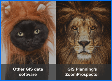
● We provide a multi-tiered solution. That means you get more than just ZoomProspector, the industry’s leading GIS location analysis tool; for the same investment, you also get six standalone interactive data tools (known as Intelligence Components) that add valuable content to your website pages. You also get a Proposal Generator, which allows you to build clean and custom proposals that can be sent using just a link AND even conduct an RFI for available properties. Trust me, this one you have to see to believe. Finally, how about those analytics? We provide you with THREE sets! One even tells you the name of your company on your website, as well as the size and type of property they are researching.
● We give you WAY more than just a GIS platform. Think of it kind of like buying a new suit or dress: We don’t just give you the one piece, we give you the entire ensemble. Shoes, accessories, all the way down to the appropriate undergarments we lovingly call “the back-end” or “Admin system.”
● We are former economic development professionals. A GIS tech company without economic developers on board cannot fully understand your needs. Pablo Monzon, Anatalio Ubalde, Russ Riblett (VP of sales), Jeff Suneson, (director of client services) - along with me, of course - are ALL recovering ED professionals who worked in government and understand personally the importance of this type of technology for business attraction/retention. In fact, we were all GIS Planning clients and have walked in your shoes. This experience means we can also provide you with best practices and ideas to help your community, leaders and brokers get onboard.
● We will NEVER pester, stalk, argue with you, call your boss/board or call your family. You'd be surprised by the stories we've heard! With nearly 25 years of experience in economic development, you can count on our stellar reputation and professionalism.
● We can set up automatic property feeds to populate your database. We work with the best-known property data vendors in the industry, including REsimplifi and Catylist. Prefer to connect to a regional MLS? We can do that too! Our client services team will work with you to get the best possible solution for your region.
● WE DRAW FROM THE SAME DATA AS ESRI – This is a biggie, I know. Take a moment to think about it. GIS Planning goes directly to the original data sources to purchase it for you. Why? Because this allows us to show the data in different ways and include other valuable data sources. Critically, it also allows us to brand it with YOUR branding and contact information in the spotlight, not the logo of a 3rd party data company with little to no reference to the site you needed the data for in the first place.
● We can connect to your ESRI server and add other local data. We can connect to your GIS or ESRI data to display your local map data. From zoning, special districts, local /regional incentive zones to co-working spaces, we can add your map data and connect to your GIS/ESRI server to help you tell your story.
So, what are some questions you'll want to ask to make sure you are getting the RIGHT software vendor for your economic development and site selection needs?
- Does Pablo work there?!
- Has anyone in the company ever actually worked in economic development?
- Tell me about the new features you recently developed. Do you charge extra for those? Are they really new or just a revamp of older, subpar technology dressed up to look like innovation?
- What’s the user interface look like? What is the user experience?
- Will you call my mom?
Want to learn more about how GIS Planning's industry-leading software can work to drive investment to your community? Click below to schedule a demo today!